
By Fernando J. Lopez, Texas Personal Injury Attorney · Updated
You took a job offer in Houston and you have one week to pick a neighborhood you have never seen. The safest neighborhoods in Houston tend to be the same handful of names every year. West University Place. The Memorial Villages. Bellaire. River Oaks. Then the suburbs. Those areas report violent crime and property crime well below the citywide figure. At The Lopez Law Group we handle injury claims across the Houston area and we get this question from clients who are moving here or moving across town.
The attorney responsible for the content of this page is Fernando J. Lopez. Our primary office is located in Weslaco, Texas.
WHAT THIS GUIDE COVERS:
- The safest neighborhoods inside the 610 Loop and the safest suburbs of Houston
- Houston crime rate by neighborhood with violent and property figures side by side
- How to read a “most dangerous neighborhood” label before you trust it
- Flood risk, traffic exposure, and what Texas premises liability law requires of property owners
The safest neighborhoods in Houston are generally West University Place, the Memorial Villages, Bellaire and River Oaks inside the loop, plus the suburbs of Sugar Land, The Woodlands, Friendswood, Kingwood, Katy, Pearland, Cypress and Clear Lake. These areas report violent crime and property crime rates well below the Houston citywide figure. Check current Houston Police Department crime data before you sign a lease.
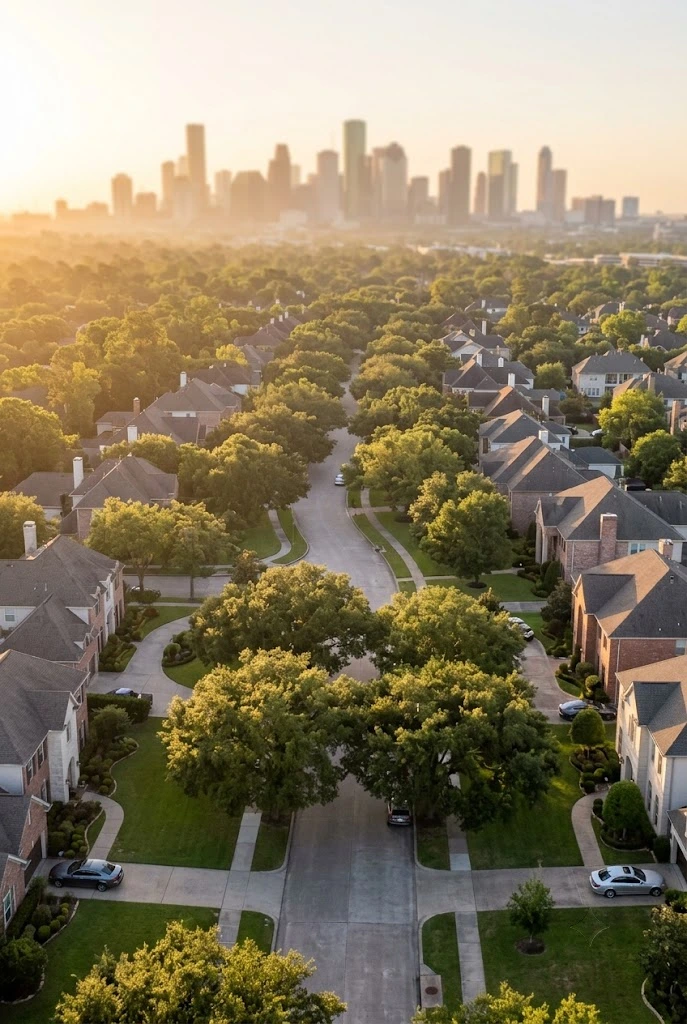
What This Post Covers
- Is Houston Safe to Live In
- Safest Neighborhoods Inside the Loop
- Safest Suburbs of Houston for Families
- Houston Crime Rate by Neighborhood
- Most Dangerous Neighborhoods in Houston
- How to Check a Neighborhood Before You Move
- The Safety Risk Nobody Ranks: Traffic
- What Texas Law Says About Property Owners
- Common Mistakes When Picking a Neighborhood
- Frequently Asked Questions
Is Houston Safe to Live In?
Houston is one of the biggest cities in the country and that size is the first thing to sort out. A citywide number covers 2.3 million people spread across more than 600 square miles. It tells you almost nothing about the street you are about to move onto. Two neighborhoods four miles apart can differ by a factor of ten. So the honest answer to is Houston safe is that parts of Houston are among the safest places in Texas and other parts carry a lot of crime. Both statements are true at the same time. Crime in Houston is a neighborhood question and never a city question. One of the safest suburbs in the state sits 20 minutes from one of the highest crime beats in Harris County.
Most neighborhood tools report crimes per 1,000 residents instead. Same idea and a different scale. Sites like NeighborhoodScout phrase it as your chance of being a victim and you will see lines written as property crime is 1 in a certain number of residents or violent crime is 1 in 22. Those phrasings all describe the same crime data in different clothing and they all report a rate of crime rather than a raw count. When you compare two areas make sure both figures use the same scale and the same year or the comparison means nothing. Houston’s size makes that mistake easy to fall into.
One more caution. Reported crime is not the same as experienced crime. Some neighborhoods report almost everything and others report very little. That gap alone can move a ranking.
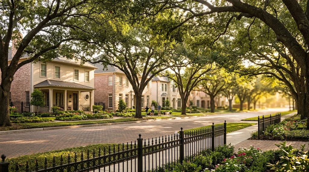
The Safest Neighborhoods in Houston Inside the Loop
You do not have to move to a suburb to find a safe neighborhood. Several of the safest places in Houston sit well inside the 610 Loop, and the best neighborhoods in Houston for safety are not always the ones farthest from the center. Treat what follows as a working list rather than a ranking, because the best places to live in Houston depend on your commute and your budget as much as on any crime number.
West University Place
A separate incorporated city surrounded by Houston with its own police department and its own city services. Home values run high and the schools draw families from across the city. West University Place shows up on nearly every list of the safest areas in Houston TX and the dedicated police coverage is the main reason.
Memorial Villages
Six separate incorporated villages west of downtown Houston, each with its own police force covering a small population. Large lots, heavy tree cover and beautiful homes. Memorial Villages listings consistently post some of the lowest crime figures in the Houston area.
Bellaire
Another incorporated city inside Houston, about six square miles, family oriented and walkable in the older sections. People searching Bellaire TX crime rate usually find numbers well under the state average for violent crime.
River Oaks
The highest home values in the city and private patrol coverage on top of HPD. River Oaks is expensive by any measure and it is quiet.
Midtown
The honest counterweight on this list. Just south of downtown, walkable and popular with young professionals who want to skip the commute. Property crime runs higher than in the residential pockets above, mostly vehicle break-ins tied to street parking and nightlife. Plenty of people love living there anyway.
Clear Lake
Southeast of the city near NASA and the water. Clear Lake neighborhoods draw engineers, retirees and young families, and the area offers boat access plus real green space. Anyone retiring in a safe Houston area should put it on the short list alongside Friendswood.
Rice University and the Texas Medical Center anchor the middle of this map, and the parks and outdoor spaces around them stay busy year round. The blocks immediately around them stay busy at all hours and that constant activity changes the risk picture in ways a raw number does not capture.
Safest Suburbs of Houston for Families
If you want more house and a yard, the suburbs are where most Houstonians end up. Here are the best suburbs of Houston by safety and what each one trades away. Parents searching for family friendly neighborhoods, the best neighborhoods in Houston for families, or the safest neighborhoods in Houston for families generally end up on this list. So do buyers looking for the gated communities Houston builders put up through the 2000s.
- Sugar Land. Fort Bend County, master planned and served by Fort Bend ISD. Sugar Land TX crime rate figures sit far below the Houston average. Brazos River Park gives the west side of town real trail access and open water views.
- The Woodlands. Montgomery County, roughly 30 miles north on I-45, built into pine forest. The Woodlands TX safety record is strong and the tradeoff is the commute if you work downtown.
- Katy. West along I-10 and served by Katy ISD, which draws families from across the region. Katy’s safest neighborhoods sit inside master planned communities with heavy homeowner association coverage.
- Pearland. South of Houston and growing fast. Pearland TX crime rate numbers stay low and the commute to the Medical Center is one of the shortest of any suburb on this list.
- Cypress. Northwest, inside Cy-Fair ISD. Cypress offers newer construction and more square footage per dollar than anything inside the loop.
- Friendswood. A small suburb between Pearland and Clear Lake with small-town charm and a strong sense of community. Friendswood TX safety numbers rank among the lowest in the metro year after year.
- Kingwood. Northeast and marketed as the Livable Forest. Kingwood safety is solid and the honest caution is water. Parts of Kingwood flooded badly during Harvey and buyers should pull the flood history on any specific address.
What Safety Costs in the Houston Suburbs
Affordable housing in these suburbs has thinned out. Sugar Land and The Woodlands have priced past what a median Houston income supports. Cypress, Pearland and parts of Katy still work for many buyers, and those remain the best places to live in Houston for anyone weighing price against safety.

Houston Crime Rate by Neighborhood
Here is the comparison table almost nobody builds. Pull each figure from current Houston Police Department crime data and record the year before you rely on it.
| Neighborhood or Suburb | Violent / 1,000 | Property / 1,000 | vs. Houston Average | Year |
|---|---|---|---|---|
| West University Place | 0.8 to 0.9 | 12 to 13 | Much lower (both) | 2024 |
| Bellaire | 2.1 to 2.7 | 22 to 26 | Lower violent; moderately lower property | 2024 |
| Sugar Land | 0.8 to 0.9 | 13 to 14 | Much lower (both) | 2024 |
| The Woodlands | 0.7 | 15 | Much lower (both) | 2024 |
| Friendswood | 0.6 to 1.1 | 5 to 10 | Much lower (both) | 2024 |
| Kingwood | 0.9 | 12 | Much lower (both) | 2024 |
| Midtown | ~4 to 8+ | ~40 to 80+ | Higher, especially property (density & nightlife) | ~2024 to 25 |
| Houston citywide | 9.2 to 11.6 | 42 to 45 | Baseline | 2024 |
Reading a Houston crime map takes about ten minutes once you know what you are looking at. HPD crime data gets published by division and by beat. Filter to the beat covering your target address and set the date range to the last full year. Look at the combined rate first, then look at violent and property separately, because a neighborhood can post a very low violent number and a high property number at the same time. The overall crime rate hides that split.
Houston Crime and Injury Numbers
Pull each figure below from the named agency and record the data year before relying on it. Numbers without a year and a source are not worth much.
| Statistic | Figure | Year | Source | Why it matters |
|---|---|---|---|---|
| Houston violent crime rate per 100,000 | 1,148 | 2024 | HPD / FBI UCR (Crime Data Explorer) | Citywide baseline for every neighborhood comparison |
| Houston property crime rate per 100,000 | 4,294 | 2024 | HPD / FBI UCR (Crime Data Explorer) | Property crime drives most neighborhood rankings |
| Motor vehicle crashes in Harris County | ~115,000 | 2024 | TxDOT Crash Records Information System (CRIS) | Frames the traffic risk most rankings ignore |
| Traffic fatalities in Harris County | 517 deaths (2025); ~546 fatal crashes (2024) | 2024 to 2025 | TxDOT CRIS | A direct comparison against violent crime totals |
| Unintentional injury deaths in Texas | Age-adjusted ~48 to 52 per 100,000 | 2023 to 2024 | CDC NVSS / WONDER / Stats of the States | State context for household risk |
Notes on the figures
- Crime rates: Consistent across FBI UCR Table 8 submissions, OpenCrime, plaincrime and HomeSnacks extracts of 2024 data (population ~2.32 million). HPD preliminary internal counts for 2024 showed ~26,800 violent and ~99,000 non-violent incidents; the per-100,000 rates above are the standardized FBI figures.
- Crashes: Harris County recorded just over 115,000 reportable motor-vehicle crashes in 2024 (TxDOT). This is by far the highest county total in Texas.
- Traffic fatalities: Harris County had 517 traffic deaths in 2025. The City of Houston alone saw 300 deaths in 2025 and a record ~341 to 345 in 2024. In 2024, Houston traffic deaths exceeded the city’s homicide count.
- Unintentional injury deaths: CDC data places the Texas age-adjusted unintentional-injury mortality rate in the high-40s to low-50s per 100,000 for the most recent complete years. Absolute counts are large; poisoning/overdose and motor-vehicle traffic are the leading mechanisms.
Houston crime statistics for 2026 are still partial because the year has not closed. When you compare years, use 2024 and 2025 side by side rather than mixing a full year against a partial one. That single habit will keep you from drawing a conclusion the crime data does not support.
Source: opencrime.us/crime-rate-in/houston · FBI Crime Data Explorer · TxDOT CRIS
The Most Dangerous Neighborhoods in Houston
Search the most dangerous neighborhoods in Houston and you will get confident lists naming specific areas. Read them carefully. Names like Spring Branch North and Galena Park turn up on those lists, and what the raw figure usually reflects is a handful of blocks or a single commercial corridor rather than an entire district full of families.
Here is what actually drives a high neighborhood number:
- Commercial corridors with heavy foot traffic. Retail theft counts land in the residential ZIP code and inflate the property crime figure for people who live nearby.
- Nightlife density. Bars and late-hour venues concentrate incidents into a few blocks and a few hours.
- Apartment complexes with failed security. Dark parking lots, broken gates and no patrol produce repeat incidents at one address.
- Vacant retail and abandoned buildings. Empty structures attract activity that shows up as crime around the surrounding blocks.
- Highway access points. Areas next to freeway ramps see both higher crash volume and higher property crime.
- Low reporting rates. Some of the worst areas in Houston post deceptively lower crime figures because residents stopped calling.
How to Check a Houston Neighborhood Before You Move
- Pull data for the exact ZIP code, not the city. Figures swing hard across a two-mile stretch and the city average will mislead you every time.
- Check the flood map before the crime map. Water has damaged more Houston homes than any other single risk. Use the FEMA map service and ask the seller or landlord directly about past claims.
- Drive the street twice. Once at 8 a.m. on a weekday and once after 9 p.m. on a Saturday. You are buying both versions of that block.
- Look at the lighting and the gates. Walk the parking area of any apartment complex at night. Burned out fixtures and a propped-open gate predict incidents better than any published statistic.
- Check school ratings even if you have no children. District scores drive resale value and turnover, and the best school districts anchor property values through soft markets.
- Map the commute and count the merges. Traffic exposure is the largest injury risk most residents face and nobody puts it on a neighborhood ranking.
- Talk to two neighbors before you sign. People who live on the block will tell you in five minutes what no dataset shows.
Run those seven steps and you will know more about where to live in Houston than any list can tell you, including this one.
Safest Houston ZIP Codes (With Crime Rates)
ZIP codes give a more precise starting point than neighborhood names, but they are still imperfect, a single ZIP can contain both very safe residential streets and busier commercial corridors. Treat the list below as a practical guide based on recent available data (primarily 2024, early 2026 figures from HPD, local police departments, and aggregated sources such as FBI UCR extracts). Always verify the exact address with current Houston Police Department beat data and the FEMA flood map.
| ZIP Code | Primary Area | Violent Crime (per 1,000) | Property Crime (per 1,000) | Notes / vs. Houston Average |
|---|---|---|---|---|
| 77005 | West University Place | 0.8 to 0.9 | 12 to 13 | Among the lowest in the metro; independent PD |
| 77401 | Bellaire | 2.1 to 2.7 | 22 to 26 | Independent PD; solid family area |
| 77024 | Memorial / Memorial Villages | ~1.0 to 1.4 | 15 to 17 | Low violent crime; mix of villages + HPD/Constable |
| 77019 | River Oaks | ~1.2 | 16 to 19 | High property values + private security |
| 77479 / 77478 | Sugar Land | 0.8 to 0.9 | 13 to 14 | Independent PD; consistently among the safest suburbs |
| 77380 / 77381 / 77382 | The Woodlands | 0.7 | 14 to 16 | Master-planned; strong HOA + county coverage |
| 77546 | Friendswood | 0.6 to 1.1 | 5 to 10 | One of the lowest property-crime figures year after year |
| 77059 | Clear Lake | Low (A-range grades) | Low: moderate | Near NASA; quieter residential pockets |
| 77345 | Kingwood | ~0.9 | ~12 | Solid numbers; check flood history carefully |
| 77094 | Energy Corridor / far west | Very low (often A+) | Very low | Frequently ranks at or near the top of ZIP lists |
| 77077 | Energy Corridor / Westchase | Moderate (often A: ) | Moderate (theft more common) | Safer than city average but not top-tier; higher density and commercial activity |
Violent crime roughly 9.2 to 11.6 per 1,000 · Property crime roughly 42 to 45 per 1,000.
Figures compiled from Houston Police Department and local municipal police department reporting and aggregated FBI Uniform Crime Reporting extracts, 2024 through early 2026.
How to Use This List
- Prioritize the independent-city ZIPs (77005, 77401, Sugar Land, Friendswood) when low crime is the top priority.
- 77077 is a reasonable "good but not elite" option for people who work in the Energy Corridor, better than the Houston average, but expect more property crime (especially vehicle-related) than in West U or Bellaire.
- ZIP boundaries cross neighborhoods. A street on the edge of 77024 or 77077 can look very different from the ZIP average.
- Always do the seven practical checks listed later in this guide (day + night drive, lighting/gates, flood map, commute, etc.).
Numbers change. Pull the latest Houston Police Department crime data by beat and confirm the year before you sign a lease or close on a house.
The Safety Risk Nobody Ranks: Traffic
Every neighborhood ranking measures one kind of harm. Crime. The larger daily risk to most Houston residents is a motor vehicle collision, and the safest Houston neighborhood on a crime map can sit right beside one of the deadliest corridors in Harris County.
Think about your actual exposure. You spend maybe an hour a day on I-45 or US-59 or the 610 Loop or the Katy Freeway or Beltway 8. Those miles carry real risk and they follow you no matter which nice neighborhood you picked. A family that moves 25 miles out for a lower crime figure and adds 90 minutes of freeway driving each day has traded one risk for a bigger one. That is a tradeoff worth doing the math on before you sign.
If a crash does happen, a Houston car accident lawyer can pull the crash report and the corridor history and show what the road itself contributed. Heavy truck traffic on those same corridors is its own problem, and a Houston truck accident lawyer handles those claims differently because federal carrier rules apply.
What Texas Law Says About Property Owners and Safety
Texas property owners owe a duty of reasonable care to people they invite onto their property. When an apartment complex or a retail center knows about a pattern of crime and does nothing about lighting or gates or security, an injured resident or visitor may have a negligent security claim under Texas premises liability law.
| Rule | Statute | What it means for your claim |
|---|---|---|
| Two-year statute of limitations | Tex. Civ. Prac. & Rem. Code § 16.003 | Most injury victims have two years from the date of injury to file suit. Miss it and the claim ends. |
| Modified comparative fault (51% bar) | § 33.001 | Your recovery drops by your share of fault and is blocked completely once your share passes 50 percent. |
| Cap on exemplary damages | § 41.008 | Limited to the greater of $200,000, or two times economic damages plus non-economic damages up to $750,000. |
| Wrongful death standing | § 71.004 | A surviving spouse, children and parents may file. See the Texas wrongful death statute of limitations. |
| Claims against a city or government unit | Texas Tort Claims Act | The notice period can run as short as six months, and a local charter can be shorter still. |
Your status on the property matters. The duty owed depends on whether you were an invitee, a licensee or a trespasser, and a premises liability lawyer will sort that out early because it shapes everything after it.
Common Mistakes When Picking a Houston Neighborhood
- Judging a neighborhood by the citywide crime rate. Houston averages hide swings of ten times or more between adjacent areas.
- Ignoring flood history. A home outside a mapped flood zone can still take water, and insurance pricing follows the claim history of the address rather than the map.
- Touring only in daylight. The character of a street after dark is the character you are going to live with.
- Trusting a single crime app. Crowd-sourced apps over-report in wealthier areas because those residents report more, which makes some safe areas look worse than they are.
- Skipping the commute test. Adding 40 freeway minutes each way raises your crash exposure far more than most crime differences between two neighborhoods.
- Assuming a gate means security. A gate broken for six months is evidence of neglect, not evidence of protection.
- Overlooking the school district when you have no children. Ratings drive resale and turnover, and turnover drives whether the block holds together.
What We See in Actual Cases
“In our experience handling injury cases across Texas, the neighborhood a client lives in tells us less than the property they were standing on when they got hurt. I’ve lived and worked in this state my whole career and I have handled claims in areas with excellent crime numbers where a landlord let the parking lot lighting stay dark for a year. Safety on paper and safety on the ground are two different things.”
Fernando J. Lopez. The Lopez Law GroupWhen Neighborhood Research Becomes a Legal Question
Everything above is preventive. You are researching because you want to avoid a problem. When someone is already hurt the question changes completely and becomes a question about who is responsible and what the law allows you to recover. That is where a Texas personal injury lawyer comes in. Call us if any of these describe your situation.
The Lopez Law Group offers a free consultation and takes injury cases on a contingency fee, which means no fee unless we recover. You pay no attorney's fee and no case expenses unless we recover for you. Call (956) 968-7800 and we will tell you honestly whether you have a claim worth pursuing.
Frequently Asked Questions
What is the safest neighborhood in Houston?
West University Place is usually named the single safest neighborhood in Houston because it operates as its own incorporated city with a dedicated police department covering roughly 15,000 residents. The Memorial Villages and Bellaire follow closely for the same reason, since each maintains its own police force rather than relying on citywide coverage. Home values in all three run well above the Houston median.
Is Houston safe to live in right now?
Houston is safe to live in for most residents, though safety varies enormously by neighborhood rather than by city. Areas like West University Place, Bellaire, Sugar Land and Friendswood report crime figures below the Texas state average, while some inner-city pockets report several times the citywide rate. Pick the neighborhood carefully and the city itself is not the problem.
What are the safest suburbs of Houston for families?
Sugar Land, The Woodlands, Friendswood, Katy, Pearland and Cypress rank as the safest suburbs of Houston for families based on reported crime and school district performance. Each combines low violent crime with strong public schools and master planned neighborhoods that hold their value through market cycles. Friendswood and Sugar Land tend to post the lowest figures year over year.
Which Houston neighborhoods have the lowest crime rate?
The low crime areas Houston residents point to most are West University Place, the Memorial Villages, Bellaire, River Oaks and the incorporated suburbs of Sugar Land, Friendswood and The Woodlands. All of these areas maintain independent municipal police coverage or heavy private patrol, which shows up directly in their reported numbers. Verify current figures through Houston Police Department data.
What are the worst areas in Houston to live?
No single list of unsafe areas in Houston is definitive because rankings depend on which year and which data source you use. Areas that appear frequently tend to have dense commercial corridors, concentrated nightlife or apartment complexes with documented security failures rather than uniformly dangerous residential streets. Always check the specific block rather than trusting a district label.
Which Houston neighborhoods do not flood?
The Memorial Villages, West University Place, parts of Bellaire and higher-elevation sections of Cypress and Katy have historically seen less flooding than low-lying areas near bayous and reservoirs. No Houston neighborhood is completely flood proof, and elevation within a single subdivision can vary by several feet. Check the FEMA flood map and the claim history for the exact address.
Is Houston safer than Dallas?
Houston and Dallas post broadly comparable crime rates and neither city is meaningfully safer than the other at the citywide level. Anyone comparing Houston vs Dallas safety should compare specific neighborhoods instead, because the variation within each city is far larger than the difference between them. Both cities have very safe areas and very high crime areas.
What are the safest zip codes in Houston?
The safest zip codes in Houston cluster around West University Place, Bellaire, the Memorial Villages and River Oaks inside the loop, plus the Sugar Land, Friendswood and The Woodlands zip codes in the surrounding counties. Zip code boundaries can cross very different areas, so confirm the figure for your specific street. Houston Police Department beat data is more precise than zip code data.
How much does it cost to live in a safe Houston neighborhood?
Housing in the safest neighborhoods in Houston runs well above the citywide median, with West University Place, River Oaks and the Memorial Villages among the most expensive addresses in Texas. Suburbs like Cypress, Pearland and parts of Katy deliver comparable safety records at a much lower cost per square foot. The pros and cons of living in each come down to commute time versus price.
Are gated communities in Houston actually safer?
Gated communities in Houston show modestly lower property crime than comparable open neighborhoods, though the effect is smaller than most buyers expect. A gate that is maintained and staffed makes a real difference while a gate that stays broken or propped open provides no protection and may create a false sense of security. Inspect the gate before you rely on it.
Neighborhood Safety Comes Down to Crime Data, Flood History and Traffic Exposure
Crime data tells you one part. Flood history tells you another. Traffic exposure on the roads you drive every day tells you the third, and it is the one almost nobody counts. Weigh all three and you will pick a better place to call home than any list can pick for you.
If you or someone in your family was hurt in the Houston area, a Houston personal injury lawyer at our firm can look at what happened and tell you where you stand. There is no cost for the conversation.
Available 24/7. Real people. Hablamos español.
Fernando J. Lopez. Founding Attorney
Fernando J. Lopez is the founding attorney of The Lopez Law Group. He has practiced Texas personal injury law for 18 years. Mr. Lopez is licensed by the State Bar of Texas. He represents clients in English and Spanish from offices in Weslaco and Houston.
Past results do not guarantee future outcomes. This article is general information and not legal advice.
Related Reading
- Houston Car Accident Lawyer, what the crash report and corridor history show about fault.
- Slip and Fall & Premises Liability Claims, what Texas law requires of apartment and property owners.
- Texas Wrongful Death Statute of Limitations, the deadlines that end a case early.
- Houston Personal Injury Lawyer, every practice area we handle across Harris County.



